A soil moisture map was created using drones and artificial intelligence in Debrecen
Using artificial intelligence (AI), researchers from the Faculty of Science and Technology of the University of Debrecen (DE) are developing a methodology for predicting soil moisture content. The procedure, carried out with multispectral and thermal cameras mounted on unmanned aerial vehicles, can make the optimization of yields more effective, and according to the plans, it will also be available to farmers – the university press center informed MTI on Friday.
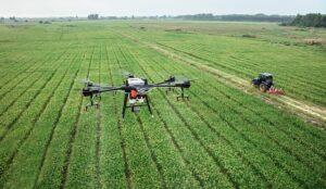
(Photo: Pixabay)
According to their announcement, the research was based on the GINOP project related to precision agriculture, within the framework of which in 2019 the natural geography and geoinformatics department of the faculty worked together with industrial players on how to effectively determine the moisture content of the soil in fields.

As part of the project, tests were carried out on a corn field and its fallow area on the border of Hajdúböszörmény
By installing a thermal camera on the industrial category drones of the department, so-called thermal orthophoto mosaics, a kind of heat map, were created. Using different data processing combinations, they investigated how the moisture content of the soil can be determined, for which it was necessary to know the actual extent of the distribution of soil moisture at the time of the investigation – assistant professor László Bertalan reported on the details of the research. According to his words, the specialists involved in the research collected soil samples, in which the moisture content of the soil at the given points was determined under laboratory conditions. At the same time, drone data collection was also carried out, on the one hand with a thermal camera, and on the other hand with so-called multispectral mapping, when differences in the soil surface were detected based on reflected solar radiation in different ranges of the electromagnetic spectrum, and then the values measured by different methods were compared.
The study is about the methods we can use to estimate the moisture content most effectively
If, for example, the soil surface is 35 degrees on the drone heat map, but next to it the moisture content is 20 percent in the case of the given soil sample, then with the help of artificial intelligence, including machine learning, we can determine a statistical correlation from the combinations of the data if there are enough soil samples – explained the specialist, noting, to present the optimal settings in the publication, with which the most accurate results can be achieved.
MTI
Related news

Artificial intelligence in winemaking: new technology is changing the way wine is made
Artificial intelligence is revolutionizing American winemaking, enabling remote monitoring of…
Read more >
Pretenders: these four technologies will compete with artificial intelligence in 2024
Quantum technology, new semiconductors, cobalt-free batteries, space technology – these…
Read more >
The aflatoxin load of Hungarian consumers was examined by Nébih specialists
The University of Debrecen and the National Food Chain Safety…
Read more >Related news

Nébih experts examined the cheapest foods
In order to protect consumers, the National Food Chain Safety…
Read more >
MBH Bank: Growth may accelerate in the second half of the year, next year GDP may increase by 3.7 percent
The outlook for the Hungarian economy is stable, so thanks…
Read more >
Scitec Nutrition launched an unusual image campaign with everyday heroes
In May, Scitec Nutrition’s “Fighters. They won. Your turn!” with…
Read more >