Meteorological service: soil recharge is gaining momentum
The recharge of the soils in autumn and winter is gaining momentum, and rainfall can be expected several times by the end of next week, the National Meteorological Service wrote in its agrometeorological analysis on Thursday.

(Photo: Pixabay)
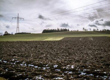
They added: in the last ten days, it only rained on the last two days, so the ten-day precipitation amount almost across the country shows a deficit compared to the many-year average. The autumn-winter replenishment of the soils is still at the beginning. The soil layer close to the surface has become wet in the southeastern two-thirds of the country and is muddy in many places, while the soil surface has remained dry in the northwest for the time being. The moisture content in the middle soil layer is satisfactory, but in the deeper layers there is still a significant lack of moisture, they added. According to the analysis, the temperature has been above the usual average in recent days as well, but the degree of positive anomaly has decreased compared to the previous period. Weak night frosts occurred mainly in the eastern part of the country from Sunday to Tuesday, but in most places the minimums were still above freezing. The temperature of the hottest hours was between 10 and 15 degrees until Sunday, after which it started to cool down a few degrees from Monday.
More and more precipitation falls on the land
According to the meteorological service, the autumn-winter replenishment process of the soils, which after the dry October continued rather slowly in the first half of November, will gain momentum in the next week. They added: after Wednesday, additional Mediterranean cyclones will reach Hungary, so rainfall can be expected several times until the end of next week. From Friday dawn, the rain will fall in more and more directions from the southwest, which may turn into sleet and snow in the northeastern regions in the evening hours, then another cyclone will arrive on Saturday, and by Sunday noon, precipitation is expected again mainly in the southern and southeastern parts of the country. On Monday, the weather will be temporarily drier, and then from Tuesday afternoon to Wednesday evening, rain is likely again in many places, which may turn into sleet and snow in the north and northeast. After the mild dawn on Friday, the weather will cool down on Saturday morning, the temperature will drop slightly below freezing in large areas in the northeast and Transdanubia, and weak frosts can be expected in many places on the other days as well.
Autumn sowing is doing well
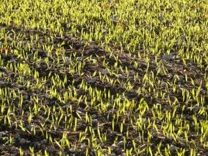
According to the agrometeorological analysis, the weather was very favorable for canola this autumn, so now very well developed and strengthened stands have formed. Sufficient moisture was available in the soil for the sowing of autumn ears of corn until mid-October, the previously sown barley thus greens up nicely, and is typically bushy, developed and in good condition. However, the later-sown wheat developed unevenly in many places on soils that had dried out by the end of October, but the November rains, where a significant amount fell, contributed to a more homogeneous stand, which was also favored by the mild weather.
MTI
Related news
Agrometeorology: soils continue to replenish
The upper half-meter layer of soils contains a lot of…
Read more >Agrometeorology: soil sufficiently moistened almost nationwide
Last week’s heavy rainfall sufficiently moistened the upper layer of…
Read more >Agrometeorology: precipitation is good for autumn sowing
This week, heavy rain fell nationwide, with the exception of…
Read more >Related news
Eckes-Granini acquires fruit juice concentrate producer in Germany
Eckes-Granini, one of Europe’s leading juice producers, has acquired Wolfgang…
Read more >The latest issue of Trade magazine is out now!
This time the digital version has been extended to 192…
Read more >After a subdued year, the holiday season is strong
74% of online shoppers, around 3.1 million people, are preparing…
Read more >


