Experts can help mitigate drought damage with digital soil and water management maps

Specialists from the Soil Science Institute (ATK TAKI) of the ELKH Agricultural Science Research Center participate in the development of digital soil and water management maps of agricultural areas within a consortium that can help predict the drought sensitivity of individual soils and plan natural water retention.
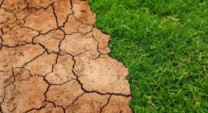
The new Hungarian development can help farmers fight future droughts. (Photo: Pixabay)
The development of digital soil and water management maps is expected to take a few years – he learned from Éva Hencz of MTI, ELKH’s communications director. The members of the consortium led by Pannon University also include the Balaton Limnological Research Institute and the Ecological Research Center. The project is implemented under the auspices of the National Laboratory of Water Science and Water Safety. This is one of the 10 national laboratories that, with the participation of ELKH researchers, can count on HUF 60 billion in support in the coming years. Knowledge of soil water management is the basis for the assessment and protection of water resources potentially stored in the soil – wrote the researchers, who, according to the researchers, should also be prepared for the expected extreme temporal and spatial distribution of precipitation in the future in addition to permanent drought. The combination of prolonged drought and subsequent sudden, high-intensity rainfall accelerates the degradation of soil structure and erosion, which also affects soil fertility. Even the soil of areas with exceptionally good water management cannot compensate for the effect of a permanent lack of rainfall. Knowledge of soil properties is important if only because the sensitivity of some soil types and plant cultures to drought or inland water differs, this complex system of relationships basically determines the future direction of sustainable plant production.
In the project that started at the beginning of July, the specialists of ATK TAKI undertook the creation of digital soil and water management maps of the production areas. According to the announcement, information on the condition of domestic agricultural areas is available in various institutions and their inclusion in GIS systems, together with hydrophysical databases, can help predict extreme water management situations and accurately assess the effects of drought and inland water. The information obtained from this can also provide a clue for the development of water management policy programs, so for example they can help in deciding where it is worth investing in irrigation.
MTI
Related news

SAP: five AI trends will transform companies in 2026
🎧 Hallgasd a cikket: Lejátszás Szünet Folytatás Leállítás Nyelv: Auto…
Read more >
Microsoft: AI will evolve from a digital tool to a digital assistant this year
🎧 Hallgasd a cikket: Lejátszás Szünet Folytatás Leállítás Nyelv: Auto…
Read more >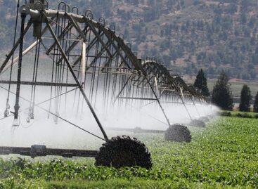
NAK: no need to pay agricultural water service fee this year either
🎧 Hallgasd a cikket: Lejátszás Szünet Folytatás Leállítás Nyelv: Auto…
Read more >More new products

Oat-based “feta” wins the cheese innovation competition of Lidl Germany and ProVeg
🎧 Hallgasd a cikket: Lejátszás Szünet Folytatás Leállítás Nyelv: Auto…
Read more >
Finger Food Experience
🎧 Hallgasd a cikket: Lejátszás Szünet Folytatás Leállítás Nyelv: Auto…
Read more >
Somersby Sour Cherry has arrived
🎧 Hallgasd a cikket: Lejátszás Szünet Folytatás Leállítás Nyelv: Auto…
Read more >