Agrometeorology: precipitation expected only in the middle of next week
The cereals sown in early October are developing nicely, but the soil has dried out during the later sowings and they are lagging behind in development, while precipitation is only expected in the middle of next week – Hungaromet Zrt. wrote in its agrometeorological analysis on Thursday.

(Photo: Pixabay)
They explained: the sunny, dry weather, frosty at night, but above 10 degrees Celsius during the day, was replaced in an increasingly large area last weekend by humid, gray, cloudy weather with temperatures barely exceeding 0 degrees day and night. Significant precipitation still did not fall, but drizzle occurred in several places from the fog and low-level stratus clouds, and industrial snow also fell near larger industrial facilities. The soil moisture content has not changed significantly over the past week, moisture loss was not typical in the damp, cool weather, but the upper 20-centimeter layer is critically dry in many places, except in the southwestern and northeastern regions of the country. The temperature has been 4-5 degrees lower than the multi-year average in the past ten days, and for the first time in a long time, the thirty-day average temperature also shows a small negative difference in most parts of the country.
In the past four weeks, autumn soil work has been progressing well in the dry, often sunny weather, the rapeseed is very developed and in good condition thanks to the rainy but relatively mild weather typical of the first half of autumn
However, in the dry weather that has lasted for a month, the upper layer of the soil, which is important for the root system of winter cereals, has dried out in many places. The cereals sown in early October have found enough moisture for optimal early development, these stands are typically in the 3-5 leaf stage or are already bushy. However, during the later sowings, the soil dried out, they emerged with difficulty and unevenly, and they are lagging behind in development.
According to the forecast, the clouds will break up in many places during the day on Friday and the sun will shine
Over the weekend and the first days of next week, fog and low-level stratus clouds will form again in many places at night, which will shrink and disperse during the day, but at the same time, permanently cloudy areas will remain, and drizzle and sleet may occur from the fog. The temperature will drop below freezing point at night in areas that have been clear for a long time, between 0 and minus 5 degrees, while in cloudier areas the daily temperature fluctuation will remain small, and values slightly above 0 degrees can be expected. In sunnier areas, the air may warm up to between 8-10 degrees during the day. From Tuesday onwards, there will be more clouds everywhere, and scattered rain is expected that day, then in many places on Wednesday, which may turn into sleet in the second half of the day and snow in the evening.
MTI
Related news

Low sour cherry harvest expected across Europe this year
Experts are predicting significant crop losses in sour cherry producing…
Read more >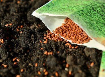
Seed Association: the proportion of metal-sealed cereal seeds should be increased
In the interest of varietal purity and crop safety, the…
Read more >
Sunflower seeds become more expensive
In its June projection, Oil World expects a global sunflower…
Read more >Related news

What makes us add the product to the cart – research
The latest joint research by PwC and Publicis Groupe Hungary…
Read more >
Energy drinks are now legal: what every shopkeeper should know
New regulations on the sale of energy drinks came into…
Read more >
Tens of millions with one opening tab – the biggest prize draw in XIXO history has started
This summer, XIXO is preparing for a bigger launch than…
Read more >