Agrometeorology: the danger of frost has not passed
Although milder nights are expected in the rest of the week, the danger of frost has not passed, in the first half of next week, nights when the temperature drops below 0 degrees Celsius can be expected again, HungaroMet Zrt. wrote in its agrometeorological analysis on Thursday.

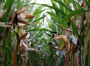
(Photo: Pixabay)
They wrote: in the week behind us, the temperature was slightly lower than usual in the first half of March, it was 1-3 degrees warmer than the long-term average. The inflow of cool air already started on Sunday, at night in the first half of the week the air cooled below freezing point in clear, windless places, and on Wednesday it was like this in the majority of the country, at which time the temperature was even lower than minus 5 degrees in some places. The soil temperature measured at 5 centimeters already exceeded 10 degrees in a large area in the second half of last week, but since then it has dropped to 7-9 degrees.

Little precipitation fell only over the weekend, the amount remaining below 5 millimeters in most places
The part of the soil close to the surface became wet in many places in the first half of March, but since then it has lost its moisture content, and it is very dry in many places in the Great Plain and the eastern part of Transdanubia. This is not good at this time of the year either, because the air over dry surfaces can cool down more on clear, windless nights than over wetter surfaces. The middle soil layer still has a good supply of moisture throughout the country, and the layer deeper than half a meter is still saturated – they wrote.
The autumn crops suffered from the long-term water coverage during the mild winter, and in many places they have already died out in the inland water spots
In those areas where there was no permanent inland water, the plants have already started to develop spectacularly, the cornflowers and the autumn cabbage-rape have started to grow, and in the latter the green bud flowers have also appeared. More and more fruit trees are sprouting and blooming, they are several weeks ahead of normal in their development. During the frosty nights of the past few days, without frost protection, the early drupes suffered significant frost damage. This year, special care must be taken in plant protection, because in the winter the pathogens and pests were decimated only to a small extent by the frost, they wrote. They added: it only rained a few times in the past week, the calculated leaf wetness period (when the leaves of the plants were wet) was low, in most places it was less than 10 percent of the period, which is favorable from a plant protection point of view, this is the reason for the spread of fungal diseases dry period was not good. A
ccording to the forecast, it is necessary to prepare for changeable weather in the continuation
On Friday, mainly in the central part of the country, light rain and showers are expected, and from Saturday evening to Sunday evening, precipitation is to be expected in several places, and from Monday the tendency for precipitation will decrease. The temperature will continue to rise until Saturday, approaching 20 degrees in several places during the hottest hours, and then on Sunday, behind a cold front, a colder air mass will again flow into the Carpathian basin, so the temperature will drop by 5-6 degrees. The air may cool below freezing in the morning on Monday and Tuesday, but according to current calculations, not in a large area, and it will start to warm again from Tuesday, with maximums of 16-21 degrees expected in the middle of next week.
MTI
Related news
Agrometeorology: summer crops would need a lot of rainfall
The summer harvest crops would need the most precipitation during…
Read more >
AM: field overview of the effects of the summer heat wave
The July analysis of the European Commission’s Joint Research Center…
Read more >
The food market is also feeling the extreme weather
In Hungary, it is expected that the price of flour…
Read more >Related news

Valeo Foods Completes Acquisition Of Appalaches Nature
Valeo Foods Group has completed the acquisition of Appalaches Nature,…
Read more >
Carrefour grows in France and Brazil, lags behind in rest of Europe
Carrefour says it is rather pleased with its financial results…
Read more >
Food and beverage innovation plunges nearly 50% since 2007: Mintel
The market research firm said about a quarter of items…
Read more >
