Agrometeorology: further precipitation is greatly needed

Although significant precipitation arrived last week after the extreme drought in June, and the drought has eased or even ended in large areas, further precipitation is needed in many places – HungaroMet Zrt. wrote in its agrometeorological analysis on Thursday.
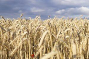
(Photo: Pixabay)
They recalled: it has rained every day since last Monday, but the regional differences are large. In the past ten days, 20 and 50 millimeters of precipitation have typically fallen, in the west, northwest and in some spots affected by major cloudbursts even exceeding this, but in many places in the central and eastern parts of the country it did not even reach 20 millimeters. Where rain exceeding 40-50 millimeters fell, the upper half-meter layer of the soil was moistened, however, in the eastern half of Transdanubia and in the southeastern and eastern parts of the country, the soil remains critically dry in many places – they emphasized. The agricultural drought has ended mainly in Transdanubia and the northeast, but where 15-20 millimeters of precipitation came together over several days, with sunny periods in between, the soil moisture reserves could not increase significantly, so the drought did not ease in essence.
According to the information, most of the autumn crops are already in storage, and the showers are causing a deterioration in quality in the fields that have not yet been harvested
Summer crops were extremely affected by the lack of precipitation in June and early July, the green mass of the crops is much less than usual at this time, and the plants are less developed. Corn is in the head-blooming phase, and sunflowers are in full bloom. The precipitation that has fallen since the beginning of last week has proven to be a lifesaver for them, they added. If further significant rainfall were to arrive, the harvest would still be acceptable, but if not, the drought would quickly return even where it had eased in recent days, they pointed out. They also drew attention to the fact that in the middle of last week, the surface of plant leaves was permanently wet throughout the country, which is a favorable condition for the development of fungal diseases.
According to the forecast, a cold vortex will determine the weather in Hungary until Saturday, with more showers and thunderstorms expected in many places
From Saturday, warmer and drier air will arrive, so the tendency for precipitation will decrease, with an average of 2-20 millimeters of precipitation expected in the area until the middle of next week. The soils will dry out again from the end of the week, and the drought will quickly return in many places. Another significant precipitation is expected on Thursday-Friday next week. If the temperature rises by Monday, then the peak value is likely to be between 32 and 38 degrees. After that, the heat will subside slightly, with a greater cooling possible on Friday, the forecast says.
MTI
Related news

István Nagy: government to help dairy farmers with around 7 billion forints
🎧 Hallgasd a cikket: Lejátszás Szünet Folytatás Leállítás Nyelv: Auto…
Read more >
Tens of thousands of producers to receive agricultural support in the coming days – Ministry of Agriculture helps farmers with accelerated payments
🎧 Hallgasd a cikket: Lejátszás Szünet Folytatás Leállítás Nyelv: Auto…
Read more >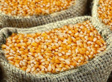
Hungarian agriculture is capable of renewal
🎧 Hallgasd a cikket: Lejátszás Szünet Folytatás Leállítás Nyelv: Auto…
Read more >Related news

What do we spread on our bread? Young people prefer butter, older people prefer margarine
🎧 Hallgasd a cikket: Lejátszás Szünet Folytatás Leállítás Nyelv: Auto…
Read more >
Products in the EU will receive a digital passport
🎧 Hallgasd a cikket: Lejátszás Szünet Folytatás Leállítás Nyelv: Auto…
Read more >
The Hungarian sports drink manufacturer has launched three new functional drinks
🎧 Hallgasd a cikket: Lejátszás Szünet Folytatás Leállítás Nyelv: Auto…
Read more >