Agrometeorology: May rain is badly needed

The soil is dry in large areas of the Great Plain and the Lesser Plain, which is why it is extremely difficult to sow seeds; although more or less precipitation will arrive at the beginning of next week along with the cooling, its territorial distribution promises to be uneven again – wrote HungaroMet Zrt. in its agrometeorological analysis on Thursday.
(Photo: Pixabay)
According to the analysis, showers and thunderstorms developed in many places in the middle of last week, and in some places there was also cloudburst, then dry weather returned with lots of sunshine from Sunday. There was no rain at all in many places in the Szeged-Jászberény-Biharkeresztes and the area bordered by the national borders, but there are also places in the northern part of the country and Transdanubia that were left out of the precipitation or received only a few millimeters. At the same time, in the southwestern, central and northern parts of the country, more than 20 millimeters of precipitation fell in large areas, and 40-50 millimeters were measured in spots affected by cloudbursts. However, in a significant part of the Great Plain, the soil continued to dry out and the upper 20, and in some places 30 centimeters of layer is in a critically dry state, and an increasing drought is being experienced. Regarding the temperature, it was written that behind a front, the weather cooled down across the country from Saturday and on Sunday, despite the abundance of sunshine, only values around 20 degrees Celsius were measured, and even by Monday morning, weak frosts occurred in the northern frosty corners, and ground frosts also developed in the lower lying regions of Nyírség and Kiskunság. The weather warmed up significantly from Tuesday, with peak values around 25 degrees returning.
The spring development of autumn sowings is progressing well due to favorable temperatures and soil moisture, rapeseed is blooming, wheat is in the development phase of stalk initiation
These plants find a sufficient amount of moisture in the soil throughout the country due to their deeper, more extensive root systems. The temperature conditions are good for the germination and early development of corn and sunflower, but there are very significant regional differences in the moisture content of the soil layer near the surface: in the regions with abundant rainfall in the past two weeks, sowing has been well-spaced, but in the Great Plain and the Lesser Plain, the soil is dry in large areas, making it extremely difficult for sowing to emerge.
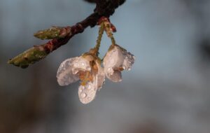
Most fruit trees have already bloomed, quinces and walnuts are still blooming in the north, the warm weather is favorable for this
The latest vegetation index value for mid-April, which shows the “greenness” of the surface, is increasing significantly throughout the country, the most intense growth during this period can be observed in the central mountains, where the trees have completely turned green in these two weeks. The vegetation is more developed than the long-term average, the spring greening is much earlier than usual.
According to the forecast, many clouds and rain, showers, and thunderstorms can be expected from Sunday to Tuesday
In total, 5-30 millimeters of precipitation are expected until the middle of next week, but due to its showery nature, the territorial distribution promises to be very uneven, so the drought affecting summer plants will likely not end everywhere in the country by the middle of next week. Cooling will begin from Sunday and on Monday the maximums will only be between 13-19 degrees, while the nights will also be very cool.
MTI

Related news

The 2026 call for applications supporting agricultural NGOs has been published
🎧 Hallgasd a cikket: Lejátszás Szünet Folytatás Leállítás Nyelv: Auto…
Read more >
István Nagy: the Ministry of Agriculture has started the preparation of a new state origin certification mark
🎧 Hallgasd a cikket: Lejátszás Szünet Folytatás Leállítás Nyelv: Auto…
Read more >
European agricultural representation: EU-Australia agreement raises serious concerns
🎧 Hallgasd a cikket: Lejátszás Szünet Folytatás Leállítás Nyelv: Auto…
Read more >Related news

Spring renewal: interest in surprising products increased in spring
🎧 Hallgasd a cikket: Lejátszás Szünet Folytatás Leállítás Nyelv: Auto…
Read more >
Rossmann celebrated women’s successes as the main sponsor
🎧 Hallgasd a cikket: Lejátszás Szünet Folytatás Leállítás Nyelv: Auto…
Read more >
Hungarians order with one sentence: this is how we shop with the help of AI
🎧 Hallgasd a cikket: Lejátszás Szünet Folytatás Leállítás Nyelv: Auto…
Read more >