Agrometeorology: snow and cold are favorable for agriculture

Snow and cold have arrived in recent days, which is favorable for agriculture; most of the precipitation fell in the Great Plain, the areas currently experiencing the most precipitation shortage – HungaroMet wrote in its agrometeorological analysis on Thursday.
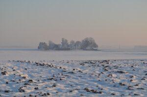
(Photo: Pixabay)
According to the analysis, there has been no example of weather in Hungary like the one in the past few days for years. By Thursday morning, a continuous 10-20 centimeter layer of snow had formed in the country, only in the northwest there is a smaller, 2-8 centimeter snow cover. In the previous ten days, 10-40 millimeters of precipitation typically fell, slightly less in the west. The total precipitation of the past 30 days is therefore 10-30 millimeters below average in the northern two-thirds of the country, while in the south it is around normal. The 90-day precipitation total is usually 10-70 millimeters short of the long-term average, with most precipitation missing in Trans-Tisza, while there is also a small surplus in the north.
The top one-meter layer of soil is saturated with moisture in the west and north
At the same time, the ground is still dry in the Great Plain below 30-40 centimeters, and at least the top one meter should be replenished by spring so that there is reserve moisture for plants next summer. The temperature has dropped significantly this week, and on Wednesday there was frost almost all day long across the country for the first time this winter. In clear areas, the temperature above the thick layer of snow dropped below minus 15 degrees Celsius in some places by Thursday morning. The top 3-10 centimeters of soil is frozen in the country, and standing water is also frozen. Rapeseed and winter cereals are dormant under the snow. Snow is very favorable, it protects plants from frost damage, and when it melts, moisture slowly seeps into the soil.
According to the forecast, severe, long-unseen minus temperatures are expected in the next 6-8 days, with a significant relief possible in the second half of next week
Light snowfall is expected in several places until Tuesday, and sleet in the southwest on Friday, but snowfall similar to the previous days is unlikely. The snow layer will remain in most parts of the country until the middle of next week. Temperatures are expected to be below average, with severe nighttime minus temperatures and daytime frosts likely. On clear nights, the temperature may drop below minus 15 degrees. Attention was drawn to the fact that figs in small gardens have not frozen for years, but without covering in the next few days, the part above the surface will not withstand the expected frosts, but will sprout from the stem in spring. Due to the new effects, there will be no summer crop wave, and then only autumn.
MTI

Related news

Four more products have been approved for drone application this spring
🎧 Hallgasd a cikket: Lejátszás Szünet Folytatás Leállítás Nyelv: Auto…
Read more >
Tibor Navracsics: rural Hungary must be further strengthened
🎧 Hallgasd a cikket: Lejátszás Szünet Folytatás Leállítás Nyelv: Auto…
Read more >
EU soybean acreage may increase
🎧 Hallgasd a cikket: Lejátszás Szünet Folytatás Leállítás Nyelv: Auto…
Read more >Related news

Big shopping begins, trade is prepared
🎧 Hallgasd a cikket: Lejátszás Szünet Folytatás Leállítás Nyelv: Auto…
Read more >
Nearly one and a half kilograms of ham and two dozen eggs: this is how Hungarians prepare for Easter
🎧 Hallgasd a cikket: Lejátszás Szünet Folytatás Leállítás Nyelv: Auto…
Read more >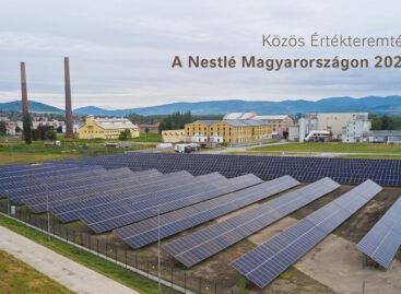
The goal is to improve the quality of life for generations: Nestlé’s summary of shared value creation has been published
🎧 Hallgasd a cikket: Lejátszás Szünet Folytatás Leállítás Nyelv: Auto…
Read more >