Agrometeorology: at the beginning of next week, the first autumn frosts may appear in frost-prone areas

Favorable, mostly dry weather for harvesting continues, but the first autumn frost may appear on Monday, the National Meteorological Service wrote in its agrometeorological analysis on Thursday.

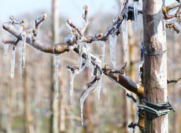
(Photo: Pixabay)
Although several weather fronts passed over the country in the recent period, only insignificant amounts of rain fell and the weather was mostly dry and sunny. The precipitation amount of the last 30 days usually shows a deficit of 10-40 millimeters compared to the long-term average. The upper 20 centimeter layer of the soil contains plenty of water almost throughout the country, and the middle soil layer also has a good water supply in most parts of the country, south of Budapest, in the central and eastern regions of the Alföld, there are drier spots. The peak temperature between last Tuesday and Saturday was typically between 25 and 30 degrees Celsius, still reminiscent of summer, much higher than usual at this time. The cold front that arrived on Sunday brought a cooling of 6-8 degrees, then another warming began and maximums of around 25 degrees were again the norm. By the morning after Wednesday’s new cold front, the temperature dropped below 5 degrees in many places.
Corn and sometimes even sunflower are being harvested
Dry, warm weather is favorable for achieving optimal eye moisture. The rain at the end of September meant a lot to the autumn cabbage rape, just as it was very necessary to moisten the upper soil layer to prepare the seed bed for the autumn ears of corn.
In the following days, the mainly dry, sunny weather will continue, although a marked cold front will arrive on Sunday, but it will not bring significant precipitation either
The temperature will rise until Saturday, then behind the cold front on Sunday, a cold air mass of Arctic origin will arrive over the country, on Monday the peak value is only likely to be between 13 and 19 degrees, and by morning the first autumn frosts may appear in frost-prone places. However, the cold air does not have much supply, it starts to warm up quickly in the high altitudes from the west, so by the middle of the week it is possible to proceed with the harvest again at a maximum of 20-25 degrees.
MTI
Related news
Agrometeorology: Autumn sowings can develop optimally, but frost threatens fruit trees
🎧 Hallgasd a cikket: Lejátszás Szünet Folytatás Leállítás Nyelv: Auto…
Read more >
Agrometeorology: the soil needs precipitation, but dry weather is ideal for flowering fruit trees
🎧 Hallgasd a cikket: Lejátszás Szünet Folytatás Leállítás Nyelv: Auto…
Read more >
Agrometeorology: autumn sowings overwintered well, even managed to strengthen at the beginning of winter
🎧 Hallgasd a cikket: Lejátszás Szünet Folytatás Leállítás Nyelv: Auto…
Read more >Related news

Damm Unveils Limited-Edition Packaging Designs To Mark 150th Anniversary
🎧 Hallgasd a cikket: Lejátszás Szünet Folytatás Leállítás Nyelv: Auto…
Read more >
Seed Association: procurement of small garden seeds has started
🎧 Hallgasd a cikket: Lejátszás Szünet Folytatás Leállítás Nyelv: Auto…
Read more >
Aldi, Auchan, Lidl, PENNY, SPAR, Tesco: in 2024 they paid more than 710 billion into the budget, while closing with a loss
🎧 Hallgasd a cikket: Lejátszás Szünet Folytatás Leállítás Nyelv: Auto…
Read more >