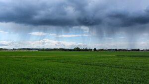
Agrometeorology: more significant precipitation is needed to recharge the soils
More significant precipitation is needed to recharge the soils, the middle and deeper layers are still very dry except for the northern and western parts of the country, but rain may arrive in several waves at the beginning of next week – wrote HungaroMet Zrt in its agrometeorological analysis on Thursday.

(Photo: Pixabay)
According to the information, in the past week, significant precipitation fell only in the eastern half of the country, in the western Transdanubia and the eastern Great Plain regions only 0.5-3 millimeters were typical, while amounts between 5-15 millimeters were measured further east, with the largest amount falling in the southeast. The 30-day precipitation total continues to show a significant deficit in most parts of the country, the amount corresponding to or slightly exceeding the usual amount at this time fell in a larger area only in the western part of the country. The rainfall totals over the past 90 days have also been significantly short, with the autumn and winter recharge of soils not yet beginning in most parts of the country. There have been significant regional and temporal differences in temperature over the past week, with night frosts returning in clear areas that have been shrinking day by day since the beginning of the week, but temperatures in overcast, humid areas have been consistently between 3-7 degrees Celsius.
Rapeseed and winter cereals are in strong, good condition in the west and north
The moisture content of the soil layer near the surface and the mild weather have been favorable for their early development. The rains that arrived in the southeastern regions over the weekend also helped a lot, but in the central part of the country, additional rainfall would be needed for optimal growth. According to the forecast, the weather is expected to be more changeable in the coming days: the cold pad will start to shrink and there may be sunny periods in the southwestern and southern parts of the country over the weekend, while the sky will typically remain cloudy in the north. Night frosts will cease across the country, in the southern regions it may be up to 15-19 degrees by the end of the week, while in the cloudier, more humid northern areas only 6-10 degrees are likely. On Monday, precipitation exceeding 10 millimeters will arrive in the north, and typically under 5 millimeters in the south, and then temporarily drier weather can be expected on Tuesday, but with this the temperature will drop and night frosts will return. The chance of precipitation will increase again in the middle of next week, with rain expected in several places.
MTI
Related news
Market reporting obligation of milk producers, milk processors and milk traders extended
🎧 Hallgasd a cikket: Lejátszás Szünet Folytatás Leállítás Nyelv: Auto…
Read more >Successful agricultural training program continues in Ghana
🎧 Hallgasd a cikket: Lejátszás Szünet Folytatás Leállítás Nyelv: Auto…
Read more >Billions in support for farm infrastructural development
🎧 Hallgasd a cikket: Lejátszás Szünet Folytatás Leállítás Nyelv: Auto…
Read more >Related news
EY: The EU customs system is undergoing fundamental changes: the reform will affect many companies
🎧 Hallgasd a cikket: Lejátszás Szünet Folytatás Leállítás Nyelv: Auto…
Read more >A single courier can save up to 9 liters of fuel per day – this is how online ordering changes fuel consumption
🎧 Hallgasd a cikket: Lejátszás Szünet Folytatás Leállítás Nyelv: Auto…
Read more >Shoppers loved chocolate bars
🎧 Hallgasd a cikket: Lejátszás Szünet Folytatás Leállítás Nyelv: Auto…
Read more >


