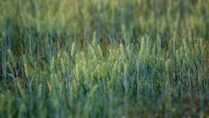
Agrometeorology: the rainy early summer period associated with the Medárd day started weeks earlier

This year, the rainy early summer period associated with Medárd’s Day began weeks earlier than usual: the rainy and thundery weather of the past three weeks significantly reduced the accumulated precipitation deficit in the spring throughout the country, and in many places it fell much more than average, HungaroMet Zrt. wrote in its agrometeorological analysis on Thursday.
(Photo: Pixabay)
They wrote that in the last ten days, between 30 and 60 millimeters of rain fell in a large area, and much less fell in smaller spots and in the southern and eastern parts of the Great Plain. Not only the soil near the surface, but in many places the upper half-meter layer has become thoroughly wetted, in the southwestern part of Transdanubia and in the areas affected by heavy downpours, it has become saturated, but in the southern and eastern landscapes of the Great Plain, there are still very dry, droughty areas. although their extent decreased further during the week. However, the moisture content of the deeper soil layer is also abundant in these places, so that, overall, plants find a sufficient amount of moisture in the upper one-meter soil layer throughout the country.
The temperature dropped from the maximum values of 25-30 degrees Celsius at the end of May, first in Transdanubia, then on Monday and Tuesday across the country below 25 degrees, but from Wednesday it started to warm up again
The autumn sowings are two to three weeks earlier in their development than usual, the grain and rapeseed fields are already yellow in many places, the ripening process has started. During the water-demanding development phases of grain formation and growth, a sufficient amount of moisture was found in the soil in most places, from now on sunny, dry, but not hot weather would be favorable for them. The current warm, rainy weather creates good conditions for the intensive development of sunflower and corn stocks. According to the forecast, after a temporary drier period, in the first half of next week, showers, thunderstorms, and possibly downpours are expected again in many places, so the upper and then the middle layer of the soil will start to get wet again in many places. The peak temperature will reach or exceed 30 degrees in a larger and larger area until Monday, and then it will drop by several degrees from Tuesday due to a cold front.
MTI
Related news
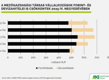
Agricultural loan portfolio decreased in 2025
🎧 Hallgasd a cikket: Lejátszás Szünet Folytatás Leállítás Nyelv: Auto…
Read more >
At the initiative of Hungary, another EU source will help farmers affected by last year’s drought
🎧 Hallgasd a cikket: Lejátszás Szünet Folytatás Leállítás Nyelv: Auto…
Read more >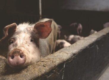
Strengthening the pig sector continues with support for breeding sow farmers
🎧 Hallgasd a cikket: Lejátszás Szünet Folytatás Leállítás Nyelv: Auto…
Read more >Related news

Oat-based “feta” wins the cheese innovation competition of Lidl Germany and ProVeg
🎧 Hallgasd a cikket: Lejátszás Szünet Folytatás Leállítás Nyelv: Auto…
Read more >
Finger Food Experience
🎧 Hallgasd a cikket: Lejátszás Szünet Folytatás Leállítás Nyelv: Auto…
Read more >
KPMG: Easter boom: the season is exploding for families, retail and the chocolate industry
🎧 Hallgasd a cikket: Lejátszás Szünet Folytatás Leállítás Nyelv: Auto…
Read more >