Agrometeorology: Plants are waiting for precipitation

The poor weather of the past week has not been good for plant development, with the exception of the western, northwestern and northeastern parts of the country, the area affected by drought has increased again, in the coming days, showers and thunderstorms can be expected in many places in the north, northwest and on Sunday in the Great Plain – wrote HungaroMet Zrt. in its agrometeorological analysis on Thursday.

(Photo: Pixabay)
In the past week, there were still rains and showers in many places on Thursday, then the precipitation tendency decreased from Friday, only on Monday there was mostly little precipitation in a larger area. In the past ten days, precipitation was 10-25 millimeters less than usual. In the northwestern and northeastern parts of the country, 10-25 millimeters fell, while elsewhere only 0-5 millimeters fell. The thirty-day precipitation total in most parts of the country was 15-40 millimeters below the long-term average, they added. The soil moisture content has decreased again, especially in the Great Plain and the southeastern half of Transdanubia, the upper one-meter layer is critically dry. 100-150 millimeters of moisture are missing for saturation. More than a third of the country is experiencing a high or severe agricultural drought, they wrote. According to the information, the temperature was still below the long-term average in the middle of last week, then warming began on Friday, and the heat peaked at 33-37 degrees Celsius on Monday. Due to a cold front, the temperature dropped by a few degrees, but there were still peak values above 30 degrees Celsius on Tuesday. The air cooled down mostly to 20 degrees Celsius at night, and several times to below 15 degrees Celsius. HungaroMet Zrt.
According to the analysis, summer crops were extremely affected by the lack of precipitation in June and early July
The green mass of the stands is much less than usual at this time, and the plants are less developed. The precipitation that arrived in the second week of July only temporarily improved the situation, in most parts of the country it was only “enough for firefighting”. If further significant precipitation were to arrive, the harvest could still be acceptable – they pointed out. In the past week, the surface of the leaves of the plants was permanently wet only last Thursday and Friday, which is favorable for the development of fungal diseases. Since then, there have been scattered wet periods in the country, lasting half a day each. Humid air occurred for a much shorter period, the first half of the week was more characterized by atmospheric drought – the analysis states.
HungaroMet Zrt. according to the forecast, the weather will become more variable in the coming days
The heat wave will peak on Friday, but the air will still warm up above 35 degrees Celsius in the southeastern part of the country on Saturday. Showers and thunderstorms are expected mainly in the northwestern part of Hungary until Saturday afternoon, and then scattered in the Great Plain on Saturday afternoon. On Sunday, precipitation is expected in many places across the country, including severe thunderstorms in some places. The temperature will drop to around 25 degrees Celsius. On Monday, scattered showers and thunderstorms are still possible. An average of 15-30 millimeters of precipitation is expected until the middle of next week. The heat will not return until the end of next week, maximum values of around 22-27 degrees Celsius can be expected, and the weather will only start to warm up in the second half of next week – the forecast says.
MTI

Related news

Four more products have been approved for drone application this spring
🎧 Hallgasd a cikket: Lejátszás Szünet Folytatás Leállítás Nyelv: Auto…
Read more >
Tibor Navracsics: rural Hungary must be further strengthened
🎧 Hallgasd a cikket: Lejátszás Szünet Folytatás Leállítás Nyelv: Auto…
Read more >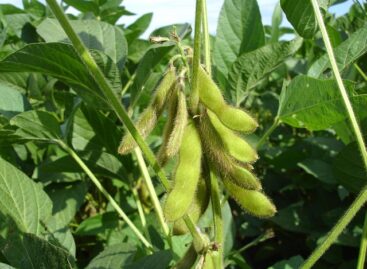
EU soybean acreage may increase
🎧 Hallgasd a cikket: Lejátszás Szünet Folytatás Leállítás Nyelv: Auto…
Read more >Related news

They’re coming, crunching and munching
🎧 Hallgasd a cikket: Lejátszás Szünet Folytatás Leállítás Nyelv: Auto…
Read more >
Big shopping begins, trade is prepared
🎧 Hallgasd a cikket: Lejátszás Szünet Folytatás Leállítás Nyelv: Auto…
Read more >
Nearly one and a half kilograms of ham and two dozen eggs: this is how Hungarians prepare for Easter
🎧 Hallgasd a cikket: Lejátszás Szünet Folytatás Leállítás Nyelv: Auto…
Read more >