Agrometeorology: milder than optimal weather
The weather is milder than optimal, and although the frost experienced in recent days has decimated the pathogens and pests, more lasting cold would be needed to significantly reduce them, HungaroMet Zrt. wrote in Thursday’s agrometeorological analysis.

(Photo: Pixabay)
They wrote: the weather of the last ten days was shaped by cold, mostly dry air masses, but on Wednesday it temporarily snowed, then sleet, and finally, due to the easing, the precipitation changed to rain in more and more places. Until Thursday morning, 1-5 millimeters fell in most parts of the country, while 8-15 millimeters fell in the northeast. However, the amount of precipitation that has fallen since mid-October is significantly higher than the average across the country, the top one-meter layer of the soil is still saturated or close to saturation, and water is also reaching even deeper layers, which means a favorable outlook for the coming year.
The average temperature of the last ten days was between minus 2 and minus 3 degrees Celsius, which is 2-3 degrees colder than the long-term average
At night, the air cooled below freezing, several times, in several places, frosts between minus 5 and minus 8 degrees occurred. A few centimeter layer of the soil near the surface was frozen over, and in some places the ground frost had retreated to 5-10 centimeters. They added: there are inland water spots in the country, mainly in the Great Plains, although their extent decreased during the dry, cold period. The frosty weather was good for the autumn crops that were covered by water. The autumn crops where there was no permanent inland water are in relatively good condition, it was not typical for the country to be so cold that it would have caused damage without the snow cover. Pathogens and pests were decimated by the frost, although a more persistent cold would be needed to significantly reduce them.
According to the forecast, the weather will be changeable, cold at first, then milder
From Friday, the temperature will drop and sleet and snow are expected in more and more places, then dry, mostly sunny weather again until Monday evening, and from then on, precipitation can be expected again several times and in more places. Night frosts below minus 5 degrees typical for the larger area will return from early Saturday, the maximums will be between 1-6 degrees until Monday, but the weather will warm up a few degrees from Tuesday.
MTI
Related news
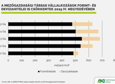
Agricultural loan portfolio decreased in 2025
🎧 Hallgasd a cikket: Lejátszás Szünet Folytatás Leállítás Nyelv: Auto…
Read more >At the initiative of Hungary, another EU source will help farmers affected by last year’s drought
🎧 Hallgasd a cikket: Lejátszás Szünet Folytatás Leállítás Nyelv: Auto…
Read more >Strengthening the pig sector continues with support for breeding sow farmers
🎧 Hallgasd a cikket: Lejátszás Szünet Folytatás Leállítás Nyelv: Auto…
Read more >Related news
Oat-based “feta” wins the cheese innovation competition of Lidl Germany and ProVeg
🎧 Hallgasd a cikket: Lejátszás Szünet Folytatás Leállítás Nyelv: Auto…
Read more >Finger Food Experience
🎧 Hallgasd a cikket: Lejátszás Szünet Folytatás Leállítás Nyelv: Auto…
Read more >KPMG: Easter boom: the season is exploding for families, retail and the chocolate industry
🎧 Hallgasd a cikket: Lejátszás Szünet Folytatás Leállítás Nyelv: Auto…
Read more >


