Agrometeorology: frosts will return next week
After the mild weather of spring, night frosts will return next week – wrote HungaroMet Zrt. in its agrometeorological analysis on Thursday.

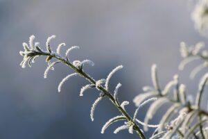
(Photo: Pixabay)
They wrote that the weather has softened significantly in the past week, as if spring had arrived at the end of January. The peak temperature was still around 0 degrees Celsius in the middle of last week, but due to the arrival of very mild air waves, the average temperature of the past five days has exceeded the usual value by 8-10 degrees. There has been little precipitation in the past ten days. The upper half-meter layer of the soil is still close to saturation in many places, with the Great Plain being slightly drier. However, in layers deeper than half a meter, with the exception of the southwestern part of the country, there is still plenty of room for moisture, with 30-80 millimeters missing from saturation in a significant part of the country, it would be good if this were made up before spring.
Rapeseed is developed and in good condition, but the picture is not so uniform for cereals sown in October
The dry period lasting a month until mid-November resulted in uneven germination and difficult early development in many places, primarily in the southern parts of the Great Plain. The precipitation that fell in the second half of November helped with this, but even though December was slightly milder than average, it was not enough for the significant development of the cereals, and very weak fields remained.
The persistent frost below minus 10 degrees, which is necessary for the thinning of pests and pathogens, has not yet occurred this winter, and on mild days, some pests have already launched an attack
Early-flowering fruit trees are now in a state of forced dormancy, and very mild weather lasting a week is very dangerous, because their sap circulation may start too early and possible more serious frosts at the end of winter and in spring can cause serious damage.
According to the forecast, mild, mostly sunny weather will remain until
Saturday From the end of the week, colder, but mostly dry air waves will arrive with a northerly flow, significant precipitation is not expected until the middle of next week. Daytime warming will gradually decrease at the end of the week, maximums are expected to be only between 1 and 6 degrees in the middle of next week, and there will be nationwide frosts next week, but temperatures below minus 10 degrees are unlikely.
MTI
Related news
Market reporting obligation of milk producers, milk processors and milk traders extended
🎧 Hallgasd a cikket: Lejátszás Szünet Folytatás Leállítás Nyelv: Auto…
Read more >Successful agricultural training program continues in Ghana
🎧 Hallgasd a cikket: Lejátszás Szünet Folytatás Leállítás Nyelv: Auto…
Read more >Billions in support for farm infrastructural development
🎧 Hallgasd a cikket: Lejátszás Szünet Folytatás Leállítás Nyelv: Auto…
Read more >Related news
EY: The EU customs system is undergoing fundamental changes: the reform will affect many companies
🎧 Hallgasd a cikket: Lejátszás Szünet Folytatás Leállítás Nyelv: Auto…
Read more >A single courier can save up to 9 liters of fuel per day – this is how online ordering changes fuel consumption
🎧 Hallgasd a cikket: Lejátszás Szünet Folytatás Leállítás Nyelv: Auto…
Read more >Shoppers loved chocolate bars
🎧 Hallgasd a cikket: Lejátszás Szünet Folytatás Leállítás Nyelv: Auto…
Read more >


