Agrometeorology: there is a chance for a cold wave and night frosts next week as well

The vegetation that developed 3-4 weeks before the usual time survived last week’s cold wave without any serious frosts, but the cold air masses of arctic origin are not far from Hungary, there is a chance of cold waves and night frosts next week as well – HungaroMet Zrt. wrote on Thursday in his agrometeorological analysis.

(Photo: Pixabay)
They wrote: in the past week, several weather fronts have affected the region. There are places where precipitation fell every day, the most, 20-30 millimeters, fell in the western part of the country on Monday and Tuesday, while the weekly amount of precipitation remained below 5 millimeters in a large area in the southeastern part of Transdanubia and the Great Plain. In the north and in the northern part of the Great Plain, water is still standing on the fields in many places, their extent is only slowly decreasing. The near-surface layer in the southern half of the Great Plain and the southeastern part of Transdanubia has dried up quite a bit in recent weeks.
The temperature dropped significantly by Thursday last week, and snow also fell in the North Central Mountains
On Thursday and Friday, the daily maximums were slightly below 10 degrees Celsius, but since the sky remained mostly cloudy at night, the air did not cool down very much, only a weak frost formed in a relatively small area for a short time.
From Saturday, milder air waves arrived again, the danger of frost has passed, and the maximums have risen above 10 degrees Celsius
The autumn sowing suffered from the long-term water coverage during the mild winter, and the inland water spots have already died out in many places. In those areas where there was no permanent inland water, the plants have already begun to develop spectacularly, their development is weeks ahead of the usual, the bushy state is already characteristic of the cornfields, and the autumn cabbage rape is starting to sprout. They drew attention to the fact that special care must be taken in plant protection this year, because the frost only decimated pathogens and pests to a small extent in the winter. More and more fruit trees are sprouting and blooming, their development is several weeks ahead of normal, and even a frost stronger than minus 2 or minus 3 degrees Celsius could cause very serious damage, they wrote. They added: it has rained several times in recent days, which is very favorable for fungal diseases, and precipitation is expected for several days in the future, so great attention must be paid to plant protection. According to the forecast, the weather will remain very changeable, the weather will soften first, and then a serious cooling may come on Monday, especially from Tuesday with night frosts. Rain and showers are expected for several days.
MTI

Related news

István Nagy: the government’s goal is to further strengthen the competitiveness of Hungarian agriculture and place the future of domestic agriculture on a solid foundation
🎧 Hallgasd a cikket: Lejátszás Szünet Folytatás Leállítás Nyelv: Auto…
Read more >
István Nagy: more than 45 billion forints in agricultural compensation benefits are coming to farmers
🎧 Hallgasd a cikket: Lejátszás Szünet Folytatás Leállítás Nyelv: Auto…
Read more >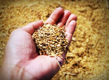
NAK President: Sowing in agriculture is about the future
🎧 Hallgasd a cikket: Lejátszás Szünet Folytatás Leállítás Nyelv: Auto…
Read more >Related news
István Nagy: the government’s goal is to further strengthen the competitiveness of Hungarian agriculture and place the future of domestic agriculture on a solid foundation
🎧 Hallgasd a cikket: Lejátszás Szünet Folytatás Leállítás Nyelv: Auto…
Read more >
Bulk shopping has become significantly cheaper: more than 900 products are available at much lower prices than a year ago
🎧 Hallgasd a cikket: Lejátszás Szünet Folytatás Leállítás Nyelv: Auto…
Read more >
EY: Activity increased, yet the value of the Hungarian M&A market decreased significantly
🎧 Hallgasd a cikket: Lejátszás Szünet Folytatás Leállítás Nyelv: Auto…
Read more >